Vermont River Conservancy just protected 14 acres on the New Haven River, with landowner Paul Fuller. 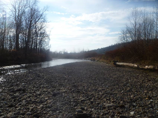
The New Haven River is an active example of how geology and hydrology interact, what river scientists call fluvial geomorphology. The New Haven drains down the steep western slopes of the Green Mountains, and as it transitions from a powerful high-gradient headwater stream to a slower, lower-gradient valley river it releases a lot of energy by flooding across the land where this slope transition happens. River scientists identified this property as important for mitigating the power of floods and for protecting downstream lands and infrastructure.
The 14.7 acres of the Fuller property covered by the easement was flooded during Tropical Storm Irene in 2011, and likely by previous storms. Sand and cobble were deposited across the property’s fields during Irene, helping minimize downstream impacts from the flooding. The river has now returned to its historic channel at the edge of the Fuller property, but will likely re-channelize through the protected property with future flood events. Because farming this land was made difficult and unpredictable by its proximity to the New Haven, a river corridor easement allows VRC and the landowner to manage the property for riparian vegetation and river meandering – vital functions in a healthy river system.
Stay in Touch
Subscribe and get the latest on VRC’s initiatives and events.