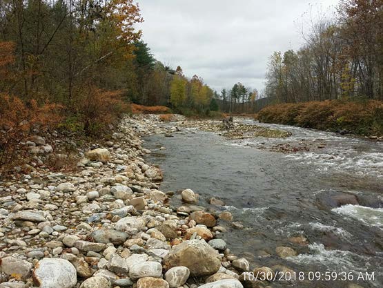
Ruane River Corridor Easement
Clarendon, Vermont
Cold River
- Public access: No
Ruane River Corridor Easement
During Tropical Storm Irene, floodwaters rushed towards Middle Road bridge, just downstream, and damaged the roadway. When state and local partners put their heads together to figure out how to prevent damage during the next big flood, they identified this parcel as a key area for conservation.
The land here should have helped store flood water during Irene, slowing the flow and filtering out damaging rocks and debris, but it didn’t. That’s because of a man-made berm — a long mound of rocks and dirt that people built-up along the riverbank, an effort to keep the river in place. Unfortunately, this type of “channelization” forces the river into a straighter and faster path, putting the river on a crash-course into the downstream bridge.
Thanks to conservation work here, the berm has been removed, and now the river can overflow across the floodplain, just as it has for millenia. Plus, the river corridor easement here makes sure the land will never be developed, and lets trees and plants grow-up along the bank, helping keep soil in place. These two tools combined — hands-on restoration and a permanent conservation easement — will help keep downstream roads and bridges safer from the next big tropical storm.
Conservation Details
- River: Cold River
- Acreage: 6.80
- River frontage (ft): 870
Funding Partners
This project made possible thanks to the support and partnership of:
- Rutland Natural Resources Conservation District
